
In brief
The Tegnùe di Chioggia are localised rocky buildups on the otherwise sandy-silty floor of the Gulf of Venice. Research links their foundations to ancient meandering river channels; marine cementation around 7,000 years ago created hard surfaces that were colonised by reef-building organisms.
At a glance
- Where
- Gulf of Venice, offshore from Chioggia
- Typical depth
- Around 20 metres in the principal study area
- Relief
- Some buildups rise approximately 3–4 metres above the seabed
- Name
- Venetian tegnùe, referring to their tendency to catch fishing nets
- Scientific significance
- A rare geological and biological habitat on a predominantly soft seabed
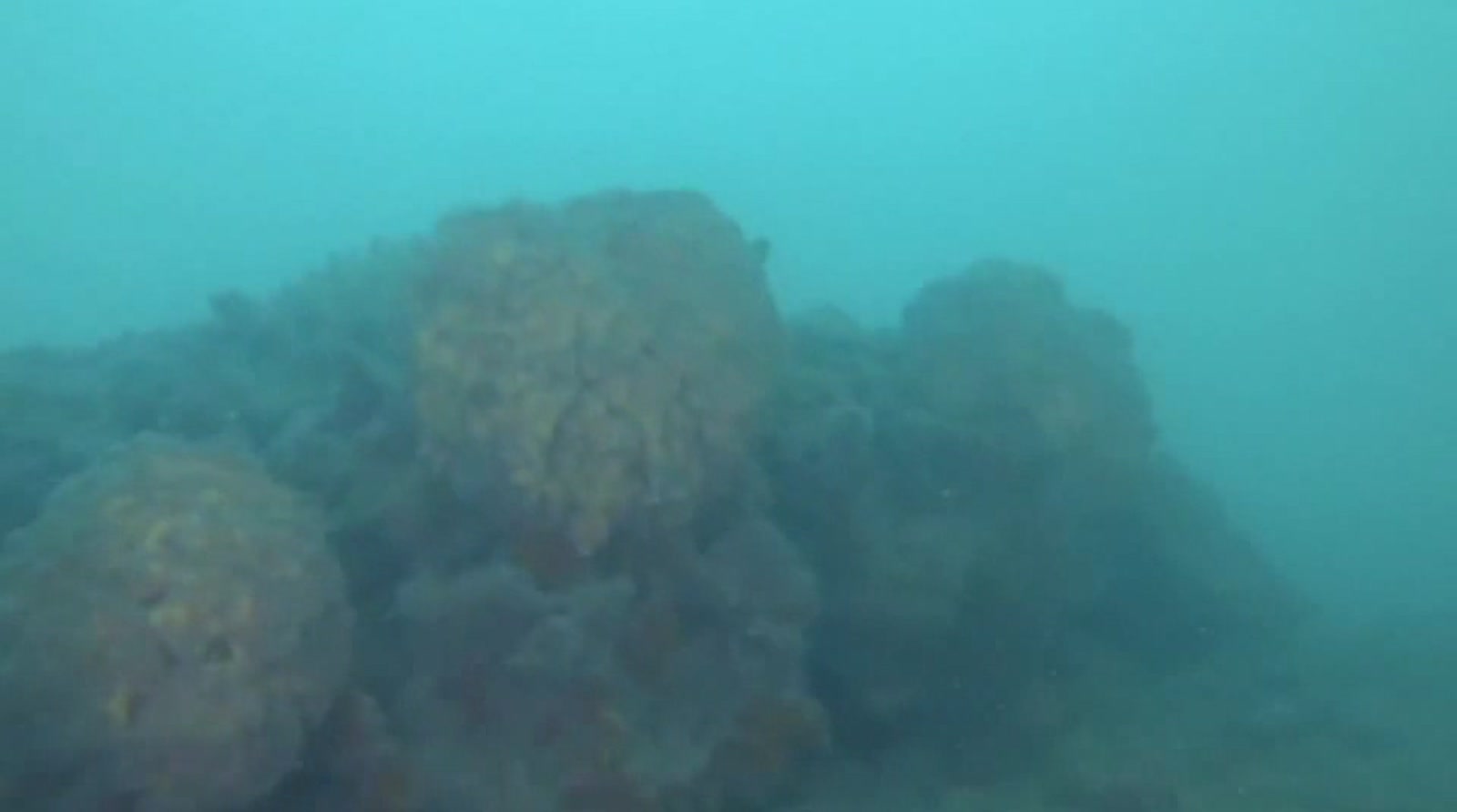
The north-western Adriatic is often imagined as a broad floor of sand and silt. Off Chioggia, that expectation fails. At roughly 20 metres below the surface, hard rocky buildups rise three or four metres from the seabed. Sponges, bryozoans, molluscs and other encrusting organisms occupy their surfaces; fish shelter and reproduce around them. To fishermen they announced themselves less gently, gripping nets dragged across the bottom. Their Venetian name, tegnùe, comes from that capacity to hold or retain. Sometimes called the Adriatic’s coral reefs, they are not tropical coral reefs. Scientists describe them as bioconcretions with strong similarities to Mediterranean coralligenous habitats. Their origin is a collaboration across immense spans of time: Ice Age rivers shaped the ground, sands cemented as the sea returned, and generations of organisms built upon the hard substrate.
A rocky anomaly
The surprise of the tegnùe begins with contrast. On a rocky coast, an underwater reef is expected. In the northern Adriatic, rivers have delivered enormous quantities of sediment, producing extensive soft bottoms. Hard outcrops become ecological islands.
The structures are not a single continuous barrier. They occur as localised patches with different shapes and compositions. Their surfaces provide the stability that many attached organisms need. Crevices and raised relief create shelter, feeding opportunities and nursery habitat. Biological complexity follows geological rarity.
Descriptions such as “oases of biodiversity” are useful but can become vague. The practical point is that a three-dimensional hard surface supports communities unlike those on nearby mobile sediment. Remove or damage the relief, and the habitat cannot be recreated quickly by simply leaving the sand alone.
The river beneath the sea
For years, proposed explanations for the formations did not fully account for their geometry and material. A multidisciplinary project coordinated by the Institute of Marine Sciences of Italy’s National Research Council combined seafloor mapping, geophysical survey, diving, sampling, isotope analysis, palaeoenvironmental evidence and electron microscopy.
Researchers conducted more than 200 dives, often in poor visibility. Their maps showed winding, meander-like patterns beneath and among the outcrops. These were interpreted as ancient river channels formed on the exposed plain during the last glacial period, around 20,000 years ago, when sea level was much lower and the modern northern Adriatic seabed was land.
As the climate warmed, the Adriatic advanced across that plain. Radiocarbon evidence from a slab of cemented sand containing mollusc shells helped date marine arrival in the studied area to about 9,000 years ago and cementation of sandy channel deposits to about 7,000 years ago. Those consolidated forms provided a foundation for early bioconstructors.
The language requires care. The living reef seen today was not completed in a single ancient event. Geological foundation and biological growth interacted over time. Later research has also investigated fluid and methane-related processes at northern Adriatic geosites, refining the mechanisms that may contribute to cementation in different locations.
A Rosetta stone made of sand and shells
The CNR team called one sampled slab a kind of Rosetta Stone. The comparison captures how several clues converged in one object. Cemented sand revealed the physical process; embedded molluscs preserved environmental and chronological evidence; its position connected the sample to mapped palaeochannels.
This is geology as reconstruction rather than spectacle. No diver watches a reef form across millennia. Instead, researchers compare mineral structures, fossils, isotopes and buried morphology. A persuasive origin story emerges from agreement among independent lines of evidence.
The result is unusual in the Mediterranean: coralligenous-like buildups developed above older fluvial meandering systems. What now supports marine life follows the ghost path of rivers that flowed when the sea was far away.
What lives on the tegnùe
The term coralligenous refers broadly to complex Mediterranean biogenic formations dominated by accumulations of calcareous organisms in low-light conditions. At Chioggia, the communities include encrusting algae and animals such as sponges, bryozoans and serpulid worms, alongside molluscs, crustaceans and fish associated with hard substrate.
Species composition varies with depth, light, turbidity, currents and the form of each outcrop. The northern Adriatic is dynamic and often cloudy; visibility can fall sharply. That makes the colour and density revealed by close observation feel almost secret. A surface that appears dull from a distance may resolve into a mosaic of living textures under a diver’s light.
The reefs provide shelter, reproductive space and feeding habitat. They can also concentrate human attention. Divers value them precisely because they break the monotony of the surrounding seabed. Fishing activity is drawn to the same biological abundance, creating the need for careful management.
The net remembers first
Long before geophysical mapping, fishermen knew where hard ground interrupted the soft bottom. A trawl that caught or tore was expensive information. Names and working knowledge mapped hazards that official charts might simplify.
The word tegnùe preserves this encounter. It describes not how the formation looks but what it does to an activity. That is a recurring feature of lagoon and coastal language: places are named through currents, depths, catches and danger.
Modern research adds chronology and mechanism to that practical map. It should not erase the fishing knowledge that first recognised the seabed’s difference. Nor should tradition be used to romanticise damaging gear. The relationship has included observation, dependence and impact.
Fragile relief in a worked sea
Hard buildups can be damaged by anchoring, lost gear and fishing methods that contact the seabed. Sediment disturbance may smother organisms; physical breakage removes structures that took long periods to accumulate. Pollution, warming, deoxygenation and changes in water chemistry add wider pressures.
Protection therefore involves more than drawing a boundary. Managers need accurate maps, cooperation with fishing communities, monitoring and ways for divers and boaters to avoid direct damage. Because the reefs are patchy, the difference between anchoring on sand and anchoring on a living outcrop may be only a short distance.
The scientific value is equally vulnerable. Tegnùe preserve evidence of sea-level rise and the transformation of an Ice Age plain into the Adriatic. Damaging the structure can destroy both habitat and geological archive.
A different image of Venice
Venice is usually pictured at the waterline: façades meeting canals, boats crossing reflected light. The tegnùe extend the region’s story downward. They connect the city’s sea to buried rivers, drowned plains and organisms that build in darkness.
They also challenge a romantic division between nature and culture. Fishermen named them. Scientists mapped them. Regulations seek to protect them. Their present condition depends partly on decisions made above the surface.
To imagine the reefs accurately, discard tropical blue water and towering coral walls. Picture limited visibility, a soft seabed and then an abrupt rise. Under a lamp, stone becomes inhabited surface. The formation follows an ancient curve—a river’s meander, preserved after the river vanished.
That is the quiet drama of the tegnùe. The Adriatic did not erase the landscape it flooded. In places, it turned that landscape into the foundation for another one.
Sources
- National Research Council of Italy (CNR), “The origin of the coralligenous of Venice revealed, the ‘tegnùe’,” 29 May 2017: https://www.cnr.it/en/press-release/7489/the-origin-of-the-coralligenous-of-venice-revealed-the-tegnue
- Luigi Tosi et al., underlying Scientific Reports study, linked from the CNR release; manuscript record: https://publications.cnr.it/api/v1/documents/download/188900
- CNR research on methane seepage and northern Adriatic geosites, providing later context for formation mechanisms: https://iris.cnr.it/retrieve/5766a87f-1025-485c-a8e3-9123d953789a/prod_485272-doc_200974.pdf
This article was independently researched and produced. No payment, complimentary service or editorial approval was provided by the places mentioned.