
In brief
Archaeologists working in the northern Venetian lagoon have identified Roman-period infrastructure associated with Altinum: an urban harbour, a channel route, two submerged well-cisterns, a pier and an oyster tank. The evidence suggests an organised lagoon economy in which shallow-draft boats connected the Roman city to the sea.
At a glance
- Where
- Altinum and the Lio Piccolo area, northern Venetian lagoon
- When
- Principally the Roman imperial period; the harbour entrance was intensively used in the first century AD
- What survives
- Submerged and buried traces of a harbour basin, pier, well-cisterns and oyster vivarium
- Why it matters
- The finds reveal a managed maritime landscape rather than an empty marsh before Venice
- What remains uncertain
- Shorelines, channels and water levels changed repeatedly; reconstructions are evidence-based but provisional
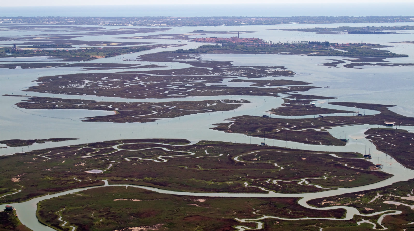
The boat slows where the northern lagoon appears to contain almost nothing. There are reed-edged barene, channels polished by the tide and a horizon low enough to make every bell tower seem improbable. This is a landscape that invites the eye to pass over it. Yet below the water, close to Lio Piccolo and the ancient city of Altinum, archaeology has begun to recover a working Roman waterscape: a pier, two well-cisterns and a tank used for oysters, positioned along a route that connected the mainland settlement to the Adriatic. The discovery complicates the familiar creation story of Venice. It does not turn Roman Altinum into an earlier Venice, and it does not prove that the medieval city simply inherited a Roman blueprint. What it shows is subtler and perhaps more interesting: people were already learning how to travel, trade, store water and cultivate food in this unstable amphibious country centuries before the Venetian Republic.
A city facing the lagoon
Altinum stood near the edge of the mainland, north of the later city of Venice. Roads tied it to the Roman land network, while waterways opened toward the lagoon and the Adriatic. Its position was not incidental. Salt water, fresh water, river traffic and maritime traffic met here, making the settlement a hinge between environments.
In 2009 remote-sensing work identified an L-shaped urban harbour basin on the eastern side of Altinum. Its orientation followed the grid of the nearby residential district. Subsequent non-invasive investigation and magnetic survey helped define the basin entrance and structures around it. According to archaeologists Carlo Beltrame and Paolo Mozzi, the width and depth of that entrance were suitable for small maritime vessels or large, flat-bottomed river barges.
That detail matters. Lagoon travel has always required compromise: enough capacity to carry people and cargo, but a shallow enough draft to cross thin water. The harbour was not merely a line on a map. It was a machine for transferring goods between different kinds of vessel and different kinds of water.
A route written below the surface
The finds farther east give the harbour a wider geography. Underwater surveys traced Roman features along a channel once used by ships approaching Altinum from the direction of the modern Lido–Treporti inlet. Two well-cisterns, a pier and an oyster tank appeared not as isolated curiosities but as points along a navigable corridor.
Today it is difficult to read that corridor with the naked eye. The lagoon has been reshaped by sediment, subsidence, sea-level change, channel migration and centuries of human intervention. A place that was dry or marginal in antiquity may now lie underwater; a channel can move, silt up or be recut. Archaeology here is therefore inseparable from geomorphology. Pottery, timber, mortar and masonry must be read together with ancient soils and drowned landforms.
The resulting picture is not of a fixed Roman coastline. It is of a negotiated zone. Boats followed channels whose usefulness depended on depth and season. Buildings and facilities occupied patches of firmer ground. The harbour network adapted to the lagoon rather than conquering it.
The wells that should not be underwater
The two well-cisterns are among the most evocative finds because their present position feels paradoxical. A structure made to secure fresh water now sits beneath brackish lagoon water. In the Roman period, however, it belonged to a different local surface and shoreline configuration.
One of the submerged well-cisterns has also yielded evidence about Roman engineering. A 2024 archaeometric study examined four mortar samples. Researchers identified cocciopesto—a hydraulic mortar incorporating crushed ceramic—mixed with local sand. They also found volcanic aggregates originating in the Phlegraean Fields near Naples, the famous pulvis puteolana valued by Roman builders for mortars that could harden in wet conditions.
The material travelled a considerable distance. Its presence suggests not only technical knowledge but supply networks capable of bringing a specialised ingredient from southern Italy to the upper Adriatic. The cistern was therefore both local and connected: built for the particular demands of the lagoon, using expertise circulating across the Roman world.
Oysters as infrastructure
An oyster tank, or vivarium, changes the emotional temperature of the site. Harbours can seem abstract until food enters the story. The tank indicates that the lagoon was not simply crossed; it was cultivated.
Oysters require a close understanding of salinity, water exchange, substrate and season. A managed tank implies repeated attention and a market for its produce. It belongs to the same practical intelligence as the harbour and cisterns: observe the water, then shape a structure that works with it.
The temptation is to call this recognisably Venetian. It is better to resist. The Roman communities around Altinum had their own political order, economy and settlement pattern. Still, the recurring actions are striking. Move through shallow channels. Protect fresh water. Build with hydraulic materials. Harvest the lagoon. Long before Venice became a maritime capital, this landscape was already teaching people a demanding grammar.
What the harbour changes
Older popular histories often begin the lagoon with flight: mainland inhabitants escaping invasion and founding settlements on remote islands. That narrative contains historical truth, but it can make the earlier lagoon sound empty and passive. The Altinum evidence replaces emptiness with continuity, change and specialised use.
There were routes before the medieval city, though not necessarily the same routes. There was maritime commerce before the Venetian state, though not its later commercial empire. There was water engineering before the great urban system of Venetian wells. Each similarity must be handled carefully, yet together they make the lagoon’s deep history visible.
The research also demonstrates why underwater heritage matters. A masonry feature below opaque water can be easy to dismiss as a ruin without context. Mapped alongside harbour geometry, palaeochannels and biological evidence, it becomes part of a system. The lagoon itself is the archaeological site.
Looking at apparently empty water
There is no grand Roman monument rising from this part of the lagoon. The discoveries ask for a different kind of attention. One has to imagine vertical change: land submerged, channels displaced, built surfaces covered by sediment. One also has to accept that the most persuasive evidence may be a mortar sample or a magnetic anomaly rather than a column.
That modesty suits the northern lagoon. Its history is dispersed among mudflats, islands and channels. Here, infrastructure rarely announces itself from a distance. It is revealed by relationships: a cistern beside a route, a pier beside a working shore, an oyster tank where tides could refresh the water.
The Roman harbour of Altinum does not diminish Venice’s originality. It gives the city a deeper setting. Venice emerged from a lagoon that already possessed memory—of movement, engineering and food production—and that memory survives not as legend but as structures beneath the tide.
Sources
- Carlo Beltrame and Paolo Mozzi, “The harbour and the lagoon of Altinum,” Ca’ Foscari Research Archive: https://iris.unive.it/handle/10278/5038180
- Beltrame et al., “Vitruvian binders in Venice: first evidence of Phlegraean pozzolans in an underwater Roman construction in the Venice Lagoon,” Ca’ Foscari Research Archive, 2024: https://iris.unive.it/handle/10278/5042620
- Paolo Mozzi et al., “Tutta un’altra storia? Spazi e funzioni tra Altino e il litorale in epoca antica,” Ca’ Foscari Research Archive: https://iris.unive.it/handle/10278/3744319
This article was independently researched and produced. No payment, complimentary service or editorial approval was provided by the places mentioned.