
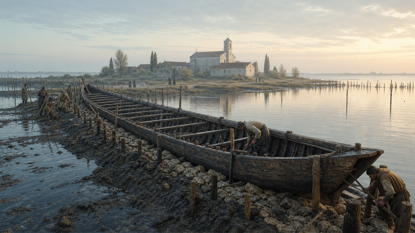
In brief
San Marco in Boccalama once received travellers, sheltered boats and supported an Augustinian community. As its ground became harder to defend, Venetians deliberately sank two old vessels along the shore and used them as part of an embankment. Centuries later, archaeologists found the lost island and a remarkably complete medieval galley beneath the mud.
At a glance
- Where
- The south-central Venetian Lagoon, near the Motte di Volpego and the Campanella channel
- Known for
- A submerged monastic settlement and two deliberately reused hulls
- Principal vessel
- A medieval Venetian galley, approximately 38 metres long and 5 metres wide
- Second vessel
- A broad, flat-bottomed transport craft, approximately 24 metres long and 6 metres wide
- Rediscovered
- The settlement was located through Ernesto Canal’s research in the late 1960s; the hulls were identified in surveys in the 1990s
- Major excavation
- 2001, under the archaeological authorities of the Veneto
- Why it matters
- The galley is the only well-preserved, substantially complete medieval example of its kind known to archaeology
On the water, there is little to announce San Marco in Boccalama. No bell tower marks the horizon. No paved edge catches the wake. The island survives instead beneath the southern lagoon, between channels and shallows, its outline held in submerged walls, timber posts and layers of silt.
This is not simply the story of a place that disappeared. It is the story of an island whose inhabitants used two retired ships as architecture—stripping them, sinking them and fixing them into the mud to reinforce a vulnerable shore. One of those vessels was a Venetian galley approximately 38 metres long. Its discovery gave archaeologists something that paintings, written rules and later models could never provide: the physical structure of a medieval galley, preserved where it had been placed centuries before.
San Marco in Boccalama brings several histories together. It was a religious settlement and a stopping place on a working water route. It became associated with the plague of 1348. It was altered by subsidence, currents and erosion. Finally, it became an archaeological site where the lagoon itself had protected what it had covered.
A stopping place at the mouth of the Lama
The island’s name preserves its geography. “Boccalama” refers to the mouth of the Lama, an old branch of the Brenta. In the medieval lagoon, such a position mattered. Waterways were roads, and small islands could serve as religious houses, landing points, shelters and markers along routes connecting Venice with the mainland.
Historical accounts place a church dedicated to Saint Mark and an Augustinian community here. A document from 1328 records work associated with the priory, including the restoration of a foresteria—a lodging place—and a cavana, a covered shelter for boats. These were made available to sailors and travellers moving along the nearby river route. San Marco in Boccalama was therefore not a remote fragment at the edge of Venetian life. It belonged to the lagoon’s connected geography: a modest but useful place shaped by movement.
Its survival, however, depended on a delicate balance. The land settled. Water levels and currents changed. Shorelines were steadily reworked. Medieval Venetians did not regard these margins as fixed; they maintained them through layers of branches, posts, earth, stone and reclaimed material. At Boccalama, that practical tradition reached an extraordinary scale.
When a hull became a foundation
The two vessels found beside the island were not wrecked in a storm. Archaeological evidence indicates that they had been deliberately prepared and positioned.
Their upper structures had largely been removed, most likely so that useful material could be recovered. The remaining lower hulls were weighted, sunk and held in place by large posts driven around their perimeters. Filled and incorporated into a shoreline structure, the ships acted as enormous timber containers—cribbing for an embankment, land reinforcement or an associated waterside construction.
The act was both economical and exact. A worn vessel still contained a considerable quantity of shaped timber. Its curved, strongly joined hull could form a ready-made retaining structure. In a city and lagoon where timber was valuable and land demanded constant care, reuse was a form of engineering intelligence.
Researchers have also identified rows of posts between the two hulls. Their arrangement suggests a substantial structure open towards the water, possibly a covered shelter for vessels linked to the monastery. The interpretation remains cautious, but the physical relationship is clear: ships, shore and architecture had become part of the same working edge.
This is the unusual beauty of Boccalama. A vessel designed to move through water was given a second role in holding water back.
The galley beneath the mud
Venetian galleys are among the defining forms of Mediterranean history. Long and narrow, powered by oars as well as sail, they served in commerce and war. They carried people, messages and valuable goods. They also embodied specialist knowledge guarded and refined within the Venetian Arsenal.
Yet no complete medieval Venetian galley survived above water. Historians relied on images, documents, construction regulations and later models. Boccalama changed the evidence.
The galley’s preserved lower hull measures about 38 metres in length and roughly 5 metres across. Posts fixed around it prevented its timbers from spreading into the surrounding sediment. The mud created an oxygen-poor environment that slowed the decay of organic material. What disappeared from view was, in part, saved by its disappearance.
Inside the bow, archaeologists found an intimate detail: a lightly incised drawing of a galley, about 30 centimetres long. The sketch shows the hull, rigging, a stern rudder and rowing arrangements. Its author is unknown. It may have been cut by a shipwright before a plank was installed, or by a crew member below deck. The excavators resisted a definitive answer, and that uncertainty is part of its appeal. On the timber of a real galley, someone who knew such vessels drew another.
The find gives scale to a world often described in institutional terms. The Arsenal, maritime routes and state fleets were immense systems, but they were built by individual hands. The graffito is one of those hands made visible.
Excavating in moving water
Archaeology in the lagoon requires a method of its own. Visibility underwater can be less than a metre. Tides alter working depth, currents move sediment and waterlogged wood can be damaged quickly if allowed to dry.
In 2001, the Boccalama investigation proceeded in two stages. Archaeologists first excavated the hulls underwater, working stratigraphically through the mud. The depths varied with tide and position, generally between about 1.3 and 2.5 metres. Once sections were recorded, the timbers were covered with geotextile and secured to limit erosion and the return of sediment.
A cofferdam of sheet piling was then built around the site and the water was pumped out. Even in the temporary dry working area, a spraying system kept the ancient wood continuously wet. Photogrammetric recording captured the hulls in detail, including images taken from a crane and a broader plan made from the air.
After documentation, the vessels were covered and submerged again. This decision can seem counterintuitive, but waterlogged wood cannot simply be lifted and left to dry. Recovery requires extensive conservation, infrastructure and long-term funding. Preservation in place, carefully protected, was the responsible course.
The excavation therefore made the lost island briefly visible without pretending it could be separated easily from the conditions that had preserved it.
An island marked by crisis
The human history of Boccalama became darker in the fourteenth century. Documentary and archaeological sources connect the site with burials during the plague of 1348. Historical research reports that the religious community had left the island in 1347, although later documents suggest a return before final abandonment. Surveys recorded numerous burials and displaced human remains in the area of the former monastery.
The evidence should be approached with restraint. It does not need embellishment. Across Venice and Europe, the Black Death forced communities to respond to mortality on an unprecedented scale. Boccalama’s position and existing religious ground made it part of that response.
The island continued to appear in later records. A protective embankment was laid across the abandoned structures in 1452, but did not last. Ceramics point to occasional activity into the sixteenth century. Maps eventually described the place as destroyed or lost. By then, erosion and subsidence had completed a process that the medieval shoreline works could only delay.
What the lagoon keeps
San Marco in Boccalama complicates the familiar division between land and water. Here, land was maintained through naval carpentry. Ships became a shore. A monastery became an archaeological seabed. Mud obscured a galley and preserved it at the same time.
The site also corrects the idea that the lagoon’s smaller settlements were peripheral. They formed a network of routes, refuges, workshops, religious houses and managed shorelines. Their histories explain how Venice functioned beyond its most visible monuments.
Nothing at Boccalama is static. The island emerged, was reinforced, inhabited, abandoned, repurposed and submerged. Even the archaeological campaign depended on temporarily changing the boundary between water and ground. That continuous negotiation is one of the lagoon’s deepest themes.
To understand Venice, it is not enough to look at what rises above the water. Some of its clearest evidence lies below: in a line of posts, a hull filled with sediment, and a small drawing scratched into a plank by a person who could not have known how long the lagoon would keep it.
Sources
- John McManamon, Marco D’Agostino and Stefano Medas, “Excavation and Recording of the Medieval Hulls at San Marco in Boccalama (Venice),” *INA Quarterly*, Vol. 30, No. 1, 2003, pp. 22–28. Institute of Nautical Archaeology. Source link
- Marco D’Agostino and Stefano Medas, “Il sito archeologico di San Marco in Boccalama e i relitti medievali,” originally published in *Quaderni Trimestrali Consorzio Venezia Nuova*, Year IX, No. 2/3, 2001. Source link
- Marco D’Agostino and Stefano Medas, “San Marco in Boccalama. Le fonti storiche,” historical-source section of the Consorzio Venezia Nuova study. Source link
- Carlo Beltrame, “The underwater archaeological heritage of the Venice lagoon,” *Venice and its Lagoons / Venice the Future*. Source link
- Convention on Wetlands (Ramsar), Standing Committee document SC36-5, Box 5: “Sunken ships in the Venice Lagoon,” pp. 19–20. Source link
- Caterina Balletti, Francesco Guerra and Andrea Lorenzon, “The Venetian Galea: From the Wooden Model to the Digital Model,” *International Archives of the Photogrammetry, Remote Sensing and Spatial Information Sciences*, 2020. Source link
This article was independently researched and produced. The hero image is an editorial reconstruction and is not presented as documentary photography.